Satellite imagery is essentially a bird s-eye view of our planet, captured by sensors on satellites orbiting high above Earth. These images go far beyond what the naked eye can see—they’re created using advanced technology that picks up light across a wide range of wavelengths, including ones we can’t see. In agriculture, this kind of imagery has become a game-changer. It helps farmers and agronomists keep an eye on large areas of farmland, monitor how crops are growing, check soil conditions, and even predict how much they might harvest—all without ever stepping into the field. One of the most valuable applications of satellite imagery in this field is the use of NDVI, which analyzes vegetation reflectance to assess plant health and detect early signs of stress.
Elevating Agriculture By Decoding Satellite Data Signals
Satellite imagery interpretation in agriculture involves analyzing images from orbiting satellites to monitor and manage crop fields remotely. These satellite images, which capture more than just what our eyes can see, offer a wealth of useful information, like how healthy the plants are, what the soil looks like, and how the land is being used. When farmers and agronomists take the time to understand these images, they can spot early signs of stress in their crops, track how things are growing, and make smarter choices about where and when to use water, fertilizer, or other resources. It’s like having a high-tech guide for the whole growing season.
Key use cases of software for NDVI images analysis in agriculture include:
- Crop health monitoring: Detect early signs of diseases, pests, or nutrient deficiencies using time-series satellite data.
- Growth stage tracking and yield forecasting: Analyze development stages to estimate yields and plan harvesting and logistics.
- Weather pattern analysis: Anticipate droughts, rainfall, or other weather events and adjust field activities accordingly.
- Soil moisture monitoring: Use radar and optical sensors to evaluate water retention and guide irrigation strategies.
- Water management: Design precision irrigation systems to reduce waste and prevent overwatering.
- Field zoning for variable-rate application: Identify surface inconsistencies and plan targeted fertilization or seeding.
- Operational efficiency: Minimize labor and fuel costs by reducing manual scouting and unnecessary field visits.
- Vegetation analysis with NDVI imagery: Visualize plant health and stress using normalized reflectance values.
NDVI: The Foundation of Vegetation Monitoring
NDVI (Normalized Difference Vegetation Index) stands at the heart of satellite-based vegetation monitoring in agriculture. Thanks to modern Earth observation satellites, farmers can now get a detailed view of their fields from space—something that goes far beyond what’s possible with a simple walk through the crops. These satellites are equipped with high-tech sensors that collect information across different types of light, including near-infrared, which is especially useful for spotting how healthy the plants are. It’s like having a health scan for your fields, helping farmers catch problems early and make smarter decisions throughout the season.

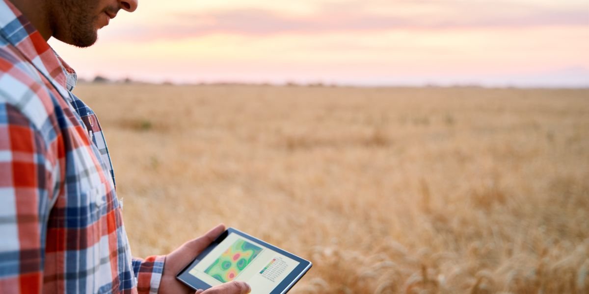
Image: NDVI analysis of the field. Source: EOSDA
This data enables the creation of vegetation indices like NDVI, which measures plant health based on how vegetation reflects different wavelengths of light. The NDVI formula is expressed as (NIR – Red) / (NIR + Red), where NIR is the reflectance of near-infrared light and Red is the reflectance of visible red light. Healthy crops absorb red light and reflect NIR, resulting in higher NDVI values, while stressed or sparse vegetation reflects more red and less NIR.
With regular satellite revisit rates, ranging from daily to weekly, farmers gain access to a consistent stream of vegetation data throughout the growing season. This time-series data supports early detection of crop stress, disease, or water issues—often before they become visible. The growing precision of satellite sensors, now reaching resolutions of 30 cm, enables highly accurate field mapping and supports strategic planning, from planting to harvest.
Future Satellite Imaging for Agriculture
Satellite imaging is set to play an even bigger role in the future of agriculture, especially as farms grow larger and the pressure to manage them efficiently increases. From now through 2028, agribusinesses are expected to lean heavily on this technology, not just for monitoring crops, but for making smarter, data-backed decisions at every stage. With clearer, more detailed images becoming the norm, farmers and managers will be able to track everything from plant health to carbon levels without ever leaving their office. These visuals don’t just help on the technical side—they also make it easier to communicate sustainability efforts and long-term land care to investors, partners, and the public.
Governments and NGOs also benefit from this technology, using it to analyze land use patterns and inform sustainable agricultural policies. Meanwhile, researchers develop and refine crop models based on satellite data, simulating plant behavior in response to various environmental inputs. These models are essential for breeding resilient crop varieties and enhancing management practices.
Looking ahead, NDVI will remain a cornerstone of precision agriculture, becoming even more powerful as satellite imaging evolves. With the growing integration of AI and machine learning, NDVI maps will offer predictive insights rather than just retrospective analysis, forecasting plant stress, yield potential, and input needs with increasing accuracy. For agribusinesses and investors, this means access to dynamic, real-time assessments of field performance across entire regions. NDVI-based evaluations will not only reveal historical productivity trends but also project future land value and suitability for different crops. This forward-looking approach will transform land acquisition strategies, enabling smarter investments rooted in data and long-term planning.
Satellite Imagery as the Backbone of Sustainable Farming
Reading satellite images isn’t just for tech experts anymore—it’s becoming a key part of how farming stays smart and sustainable. With rising pressure on land, water, and climate, farmers need tools they can trust to help them make quicker, better decisions. One of the most helpful tools is the NDVI map, which shows how healthy crops are, so farmers can use water, fertilizer, and pesticides more efficiently. That means stronger harvests with less waste. By using this kind of data in everyday farming, growers can boost productivity and protect their land for the long run. It’s clear: satellite imagery is helping shape the future of farming—one smart decision at a time.
About the Author:
Vasyl Cherlinka is a Doctor of Biosciences specializing in pedology (soil science), with 30 years of experience in the field. With a degree in agrochemistry, agronomy and soil science, Dr. Cherlinka has been advising on these issues private sector for many years.


